A LINEINTEL COMMAND SOLUTION
Contractor & Crew Coordination
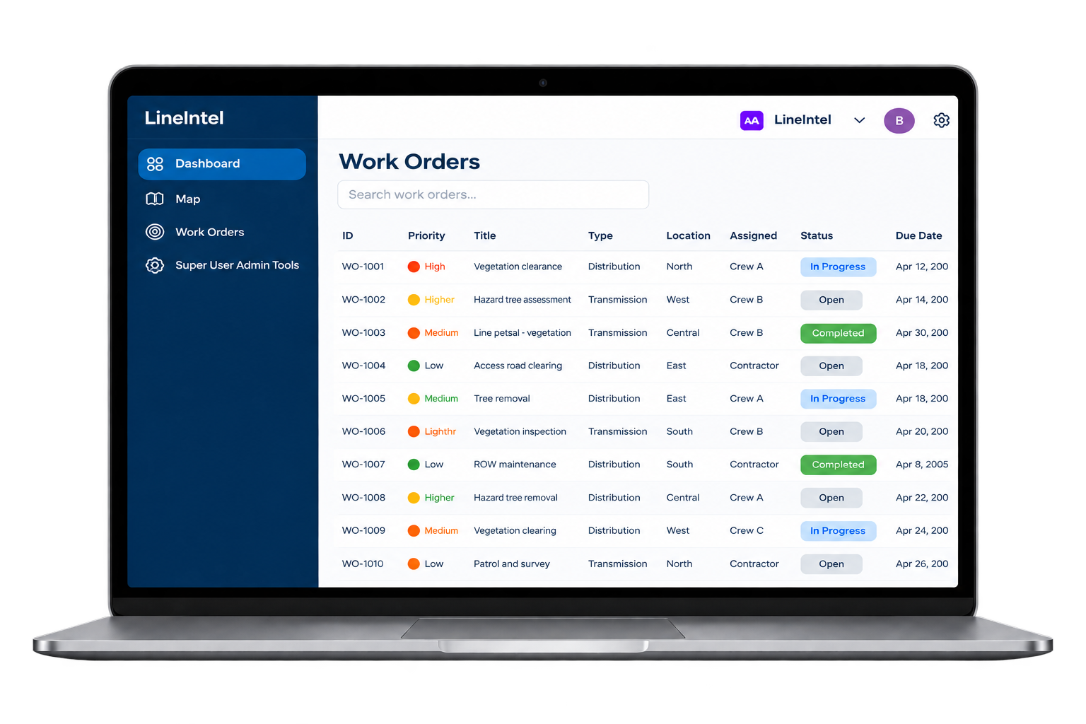
Connect utility planners, contractors and crews through shared assignments and field updates.
The Challenge
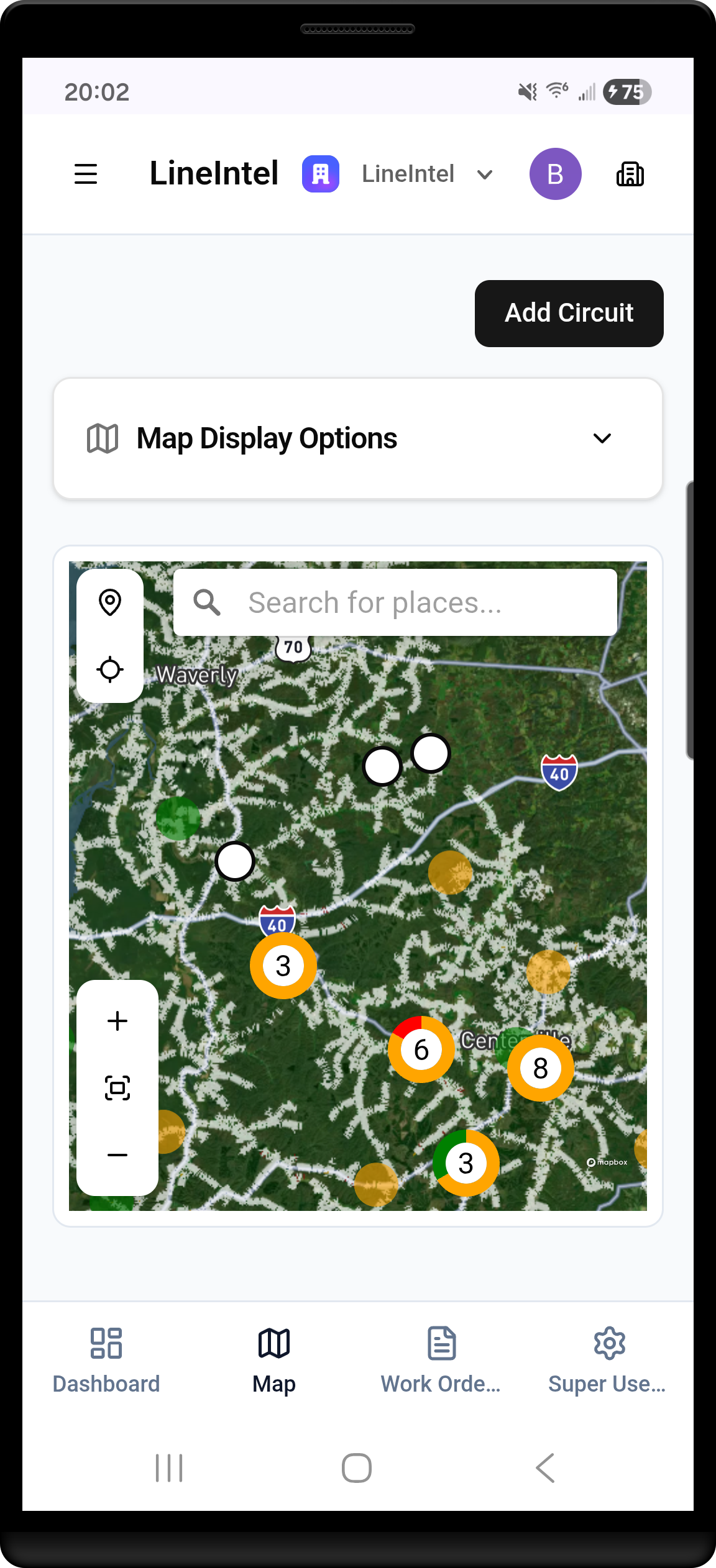
Manual handoffs can leave teams working from different versions of the plan. Command keeps location, assignment and status together so managers can see the work and crews can act on it.
- View priorities and assignments together
- Connect work orders to the system map
- Share work details with field teams
- Capture progress, notes and images
- Review completed work before the next assignment
Clear handoffs
Keep the location and scope of an assignment close to the work.
Field visibility
Bring progress updates back into the operating view.
Stronger coordination
Give planners a consistent basis for follow-up with contractors and crews.
How Command connects the work
- 01
See
Bring existing system data, work records and field observations into one visual operating view.
- 02
Prioritize
Decide what matters first using location, actual need and operating context.
- 03
Act
Assign work, connect crews and capture status, notes and images from the field.
- 04
Improve
Review outcomes and use operating history to guide the next planning cycle.
Start in the field. Build a broader system view.
Start with field execution. Expand to network-wide insight.
Start with Command and your field teams.
Put priorities, assignments and mobile field execution in place using the information you already have. Command gives office teams and local crews a shared workflow to plan, carry out and document work across the distribution system.
The first enabling capability
Coordinate the work, capture progress and build an operating record with your crews from day one.
Example imagery and product views illustrate the workflow. Aerial and ground photos show separate observations.
COMMAND IN PRACTICE
From storm response to everyday work.
During Ice Storm Fern in 2026, Meriwether Lewis used Command to coordinate dispersed crews and verify completed work.
Read the Meriwether Lewis story →- <4 hours
- From shapefiles to operating view
- 500+
- Work orders reported
- Beyond the storm
- Continued use for vegetation work management
Start with the data you already have.
No new inspection cycle required. We’ll coordinate access, review your data and help select a practical starting workflow.